Click to see in full sizeHaz click para ver en grande
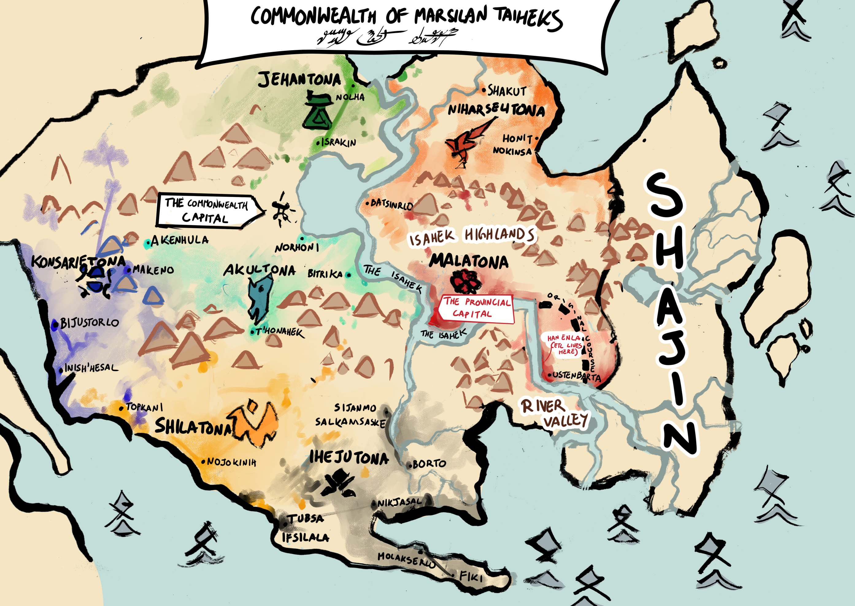
NOTE: You do not need to read this page to understand the comic. Despite appearances, the world of this comic is fairly small – about 90% of it takes place in a single building. Additionally, the characters themselves don’t have access to the sort of documents that would be considered proper maps in the 21st century, so if you ignore this page completely, you’re doing about as well as they are!
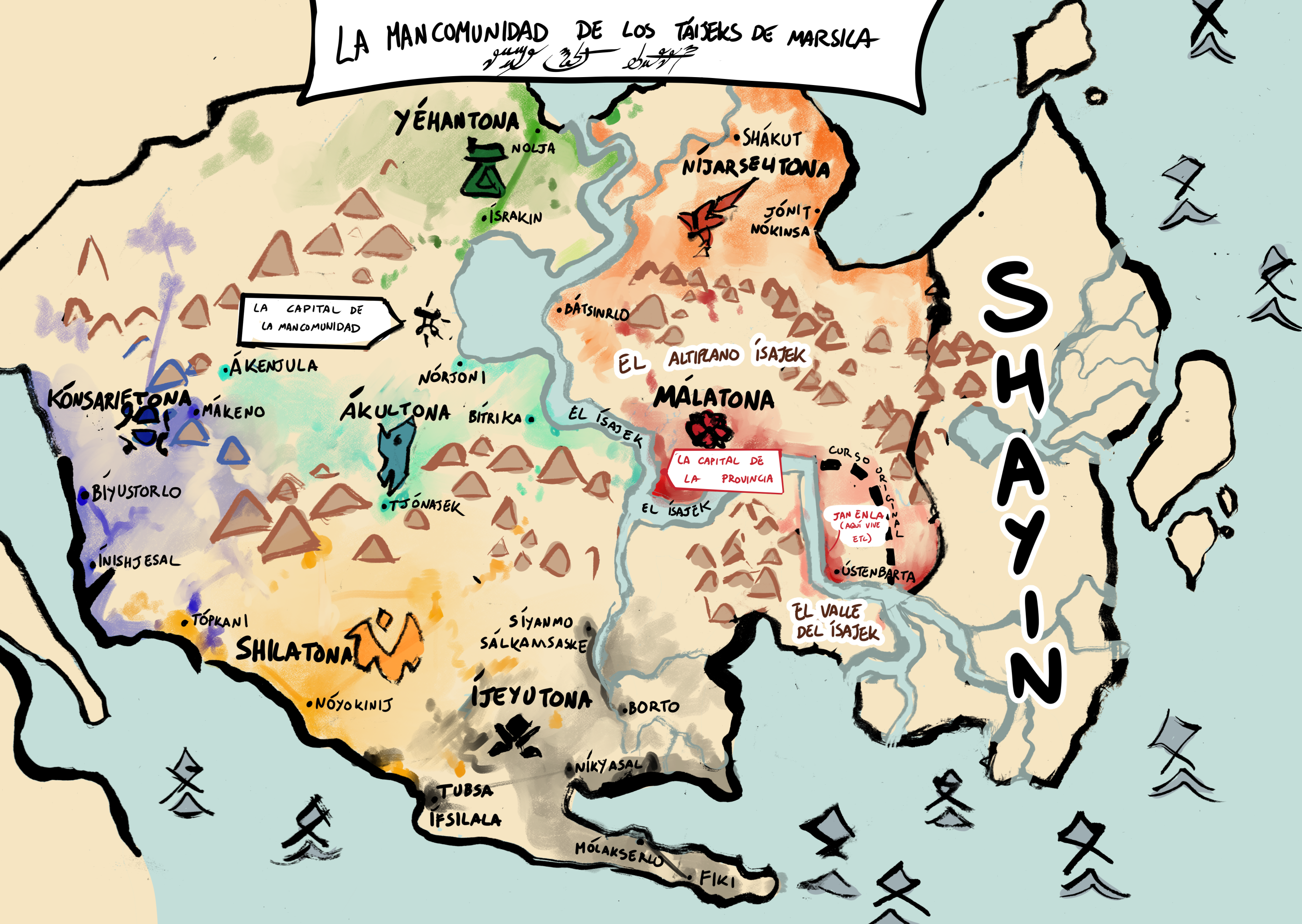
OJO: No se tiene que leer esta página para entender el cómic. A pesar de las aparencias, el mundo de este cómic es muy pequeño – cerca del 90% de él ocurre dentro de un solo edificio. Además, ni los mismos personajes tienen acceso al tipo de documento que se considera un mapa adecuado en el siglo XXI, asi que quién ignore esta página por completo, ¡va igual de bien que ellos!
The map above depicts the geographic aspects of the extended clan ownership of the 7 ruling clans of the commonwealth. Clan ownership comes in many forms. Colored areas represent where the corresponding ruling clan has claims of direct ownership, tributary agreements with local landowners, or significant political, military, or economic presence. Lighter colors indicate a weaker, more unstable, or less formal claim.
Este mapa plasma la dimensión geográfica de la extensión total de la propiedad de los siete clanes gobernantes de la mancomunidad. Existen varias formas de posesión dentro del sistema socio-familiar marsileño. Las regiones pintadas de color representan dónde el correspondiente clán gobernante tenga la demanda de propiedad en sí, o bien dónde existan acuerdos de tributo con terratenientes locales, o haya significante precensia política, militar, o económica. Los colores ligeros indican una relación más debil, inestable, o menos formal.